

The United Nations General Assembly has adopted a resolution calling for improvements in global mapmaking so that maps more accurately reflect the real sizes of continents and geographical regions.
The move seeks to address distortions associated with traditional world maps, particularly the enlargement of areas near the poles and the relative reduction of regions closer to the Equator.
The resolution, introduced by the African Union and Togo with French backing, received support from 164 countries, while the United States voted against it and six members abstained.
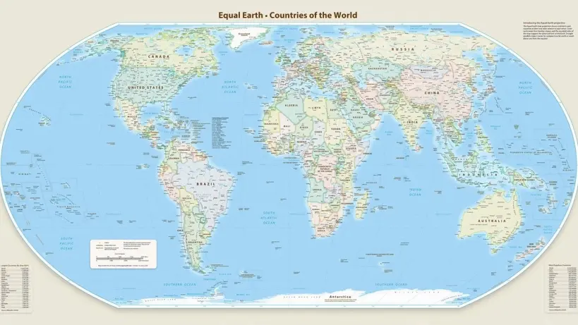
It encourages countries and international organisations to use maps based on the Equal Earth projection instead of the Mercator projection, a mapping method developed by cartographer Gerardus Mercator in 1569 to address a practical challenge faced by maritime navigators.
The Mercator projection became widely used because it preserves compass directions, with straight lines on the map corresponding to constant compass bearings. This allowed sailors to use the projection when plotting routes at sea. However, preserving direction came at the expense of accurate area representation, causing land masses to appear progressively larger as they move farther from the Equator and creating significant differences between the apparent and actual sizes of continents.
The UN resolution noted that such distortions have contributed to the symbolic shrinking of Africa and helped maintain an unbalanced perception of the world. Under the Mercator projection, Greenland appears roughly comparable in size to Africa, despite Africa being about 14 times larger in area.
The resolution encourages the use of the Equal Earth projection, which presents continental areas more accurately. Togo’s Foreign Minister Robert Dussey said maps influence education, imagination and collective perceptions, arguing that they cannot be considered neutral when they provide a distorted representation of the planet.
Dussey connected the initiative to broader African efforts to address the legacy of the colonial era, while stressing that it was not directed against Europe or any particular country, civilisation or mapping tradition. He said the initiative is guided by a global ambition to promote scientifically accurate knowledge, respect for truth and equal dignity among peoples.
The US representative to the UN, Yarinha Verensivich, meanwhile argued that such resolutions and what she described as ideological agendas undermine the organisation’s work and credibility, saying the focus should instead remain on global peace, prosperity and relations between countries rather than map projects dating back to the 16th century.



Thank you for being part of our community. Read our Comment Policy before posting.
Comments
Loading the conversation…