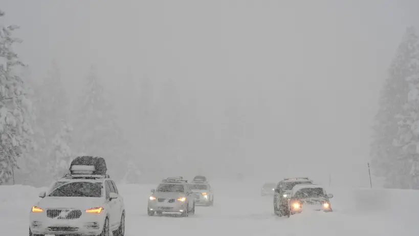
More than 35 million people across New York City and the northeastern United States are preparing for a major winter storm. Blizzard warnings are in effect, and the storm is expected to bring heavy snowfall and strong winds that could cause significant disruptions.
Currently, around 6,500 flights have been cancelled as the blizzard warnings extend from New Hampshire all the way to Virginia. This vast area, which includes the Mid-Atlantic and New England, could see between 15 and 20 inches (38 to 50 centimeters) of snow as the storm intensifies from Sunday into Monday. It's noteworthy that this is the first blizzard warning for New York City since 2017, according to Rob Carolan, owner of Hometown Forecast Service.
In New York City, winds are expected to gust up to 50 miles per hour (approximately 80 kilometers per hour), with even stronger gusts of 70 mph possible along the coast. Residents should prepare for a wintry mix that will transition to all snow. "The main show for them is tonight into tomorrow," explained Brian Hurley, a senior forecaster at the U.S. Weather Prediction Center. Central Park in Manhattan might see as much as 20 inches of snow by the time the storm subsides on Monday. Due to this forecast, Mayor Zohran Mamdani has urged residents to stay indoors and avoid using the roads.
In other parts of the region, Philadelphia and Boston might receive up to 19 inches of snow, while Washington, D.C., is expected to get off lightly with just three inches, according to the National Weather Service.
This storm poses a serious threat to many areas across the Northeast. Hurley described it as a "potentially crippling storm," with the capability of causing extreme impacts. The National Weather Service's alert system ranks this storm at the highest level. The agency has advised against travel, warning that widespread closures and disruptions to infrastructure are likely.
The combination of heavy, wet snow and high winds is expected to result in significant travel delays on the ground and in the air. Power outages could also occur across the Mid-Atlantic and Northeast. As of 8 a.m. New York time, 6,564 flights within and around the U.S. had been cancelled. Cities like New York, Newark, Boston, and Philadelphia are among the most affected, according to FlightAware. Delays are also anticipated for New York subway trains, and the Long Island Railroad will operate on a weekend schedule on Monday, as stated by Metropolitan Transportation Authority chairman Janno Lieber.
In response to the impending storm, New York Governor Kathy Hochul has declared a state of emergency for New York City, Long Island, and parts of the Hudson Valley. New Jersey has also declared a state of emergency, while Connecticut Governor Ned Lamont has advised residents to stay off the roads from Sunday night through Monday morning.
As the storm progresses along the coast, it's expected to rapidly intensify, meeting the criteria for what meteorologists refer to as a "weather bomb." This term is used when a storm's central pressure drops by 24 millibars within 24 hours. Forecasts indicate this storm could nearly double that, with a 40 millibar decrease, Hurley noted.


Comments
Log in to write a comment